Delhi Wakes Up to Rain, Yellow Alert Issued as More Showers Expected Today
Heavy rainfall swept across parts of Delhi-NCR on Monday morning, offering a significant relief from the prevailing heat and humidity.

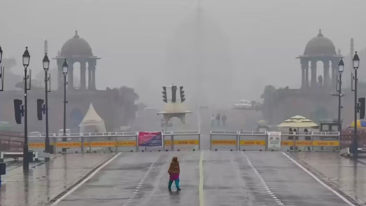
Delhi: Heavy rainfall swept across parts of Delhi-NCR on Monday morning, offering a significant relief from the prevailing heat and humidity. The early downpour brought cooler temperatures and improved air quality, providing much-needed comfort to residents who had been enduring days of hot and muggy weather. The showers also led to waterlogging in some low-lying areas.
According to the weather department, the maximum temperature in Delhi was 35 degrees Celsius on Sunday, with the minimum rising slightly to 28.8 degrees.
The prediction for the next two days is a generally cloudy sky with light to moderate rain accompanied by thunderstorms and lightning over Delhi and NCR, and very light to light rain through the rest of the week from Wednesday to Sunday.
Also Read: Sachin Hails Shubman Gill’s First Win as Test Captain; Ganguly Says ‘Without Bumrah’
As per IMD website, Delhi was under an yellow alert on Monday and Tuesday.
Delhi may see a stable temperature through the week, with the maximum ranging from 32 to 34 degrees Celsius. The residents of the national capital will surely welcome a respite from the heat and humidity.
The weather department issued a warning for the next two hours at 6.30 am on X stating that light to moderate rainfall accompanied by thunderstorm is expected in Delhi-NCR region. The wind speed is likely between 30-40 Km/h gusty winds.
“Light to moderate rainfall accompanied with light thunderstorms and lightning (30-40 Km/h gusty winds) is likely to occur at entire Delhi and NCR, Narwana, Fatehabad, Barwala, Jind, Adampur, Hissar, Gohana, Gannaur, Hansi, Siwani, Meham, Sonipat, Tosham,” the IMD said on X.
Several areas in Delhi-NCR reported waterlogging following the morning rain. Key stretches, including the Mehrauli-Badarpur road, were inundated, causing traffic snarls and inconvenience to commuters. Vehicles were seen navigating flooded streets in multiple parts of the city.
Also Read: Texas Floods Kill 82, Trump’s Visit Likely Amid Search for Missing Girls
The IMD has further indicated that intermittent rain will continue from July 7 to July 11, with overcast skies likely to persist. The Lodhi Road area recorded the highest temperature at 35°C, while Ridge, Aya Nagar, and Palam recorded 34.8°C and 33.5°C, respectively.
After days of dry alerts with no rain, the long-awaited showers have revived hopes for a cooler and more comfortable week ahead. The public is advised to stay updated with IMD alerts and plan travel accordingly as brief spells of heavy rain and strong winds may cause temporary disruption.
Meanwhile, the Air Quality Index (AQI) in Delhi remained in the 'satisfactory' category for the 11th consecutive day on Sunday, the cleanest spell recorded so far this year.
Earlier, the Met Department placed weather warnings for 7-8th July. It said, “Axis of Monsoon trough is over Northern India and its active and a upcoming WD trough dipping over the region a large scale massive heavy rains and thunderstorm events is likely to occur in Delhi and NCR, N-NW Rajasthan, Haryana, Parts of Punjab, NW-W Uttar Pradesh and parts of Jammu, Kashmr, Himachal and Uttarakhand tonight into tomorrow.”
It further stated that the trough will only remain over North India for a few days because to this configuration's sufficient instability, moisture from both seas, and moisture at mid levels
Also Read: Trump Warns of Tariffs on Nations Backing Anti-American BRICS Policies
For breaking news and live news updates, like us on Facebook or follow us on Twitter and Instagram. Read more on Latest National News on The National Bulletin